Carlson SurvCE
Carlson SurvCE is a robust field data collection solution for RTK GNSS, total stations, and data controllers. It features a highly graphical UI, supports hundreds of equipment models, enables voice prompting, GIS and Surface inspection, and simplifies staking workflows for fast, accurate field operations.
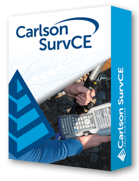
Carlson SurvCE is designed for surveyors needing efficient, accurate field data collection with GNSS and total stations. Its intuitive, highly graphical interface simplifies staking, surface comparison, and coordinate geometry workflows.
SurvCE supports hundreds of RTK GNSS receivers and total stations from Carlson, Leica, Topcon, Trimble, Sokkia, Spectra, Geomax, and more. Field-to-Finish integration and hybrid GNSS + RTS workflows allow flexible, real-time surveying. Features include enhanced search, voice-guided staking, GIS and Surface inspection, obstructed point staking, and automatic backsight checks.
Carlson SurvCE streamlines field operations, reduces setup errors, and increases productivity, offering unmatched versatility for professional surveyors using Windows Mobile CE 6 devices.
Versatile Equipment Support
• Works with hundreds of GNSS receivers and total stations.
• Compatible with Carlson, Leica, Topcon, Trimble, Sokkia, Spectra, Geomax, and more.
Intuitive User Interface
• Highly graphical, designed by surveyors for surveyors.
• Voice prompting keeps users’ eyes on the field while staking.
• Enhanced search across all live survey screens with multiple search methods.
GIS & Surface Inspection
• GIS Inspector provides instant access to map attributes.
• Surface Inspector enables comparison of plan vs. as-built elevations.
Advanced Stakeout Tools
• Obstructed Point Stakeout guides staking of hard-to-reach points.
• Hybrid+ module combines GNSS and RTS for rapid and reliable staking.
• Automatic Backsight Check simplifies setup verification.
Workflow Efficiency
• Enhanced Field-to-Finish support streamlines field data collection.
• Works with Windows Mobile CE 6 devices for durable, on-site performance.
• Supports KML export, camera integration, and direct cloud/collaboration workflows.
Carlson Software is more than just a purchase—it’s a partnership.
With dedicated Regional Managers across the country, free lifetime technical support, and flexible training options to fit any budget, we’re here to support you every step of the way.
Direct Technical Support
• Hours: Monday – Friday, 9 AM – 5 PM
• Email: tim@carlsongs.com
• Telephone: +1 (716) 799-4187
Similar Products You May Like
Carlson Layout
Fast, intuitive Android-based layout software for construction professionals using total stations or GNSS receivers.
See Product

