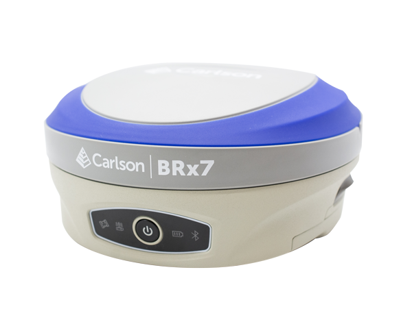
Carlson Viking
NewThe Carlson Viking is an American-built flagship GNSS receiver delivering centimeter-level precision in the most difficult environments, where TRIPLE-FIX technology pairs dual RTK modules with three independent RTK engines to essentially eliminate false fixes. Use it as a base or a rover, with calibration-free tilt compensation and radio, cellular, Wi-Fi, and Bluetooth communications managed from a powerful web-based UI.
With 632 channels, the Viking simultaneously tracks all major constellations — GPS, GLONASS, BeiDou, Galileo, QZSS, and NavIC (IRNSS) — with support for L-Band corrections. A 4G cellular modem, 400 and 900 MHz UHF radio, Wi-Fi, Bluetooth, serial, and Ethernet-over-USB interfaces keep corrections flowing in any configuration. Advanced signal processing provides best-in-class anti-jamming and anti-spoofing protection, mitigates reflected signals around buildings and heavy machinery, holds accuracy under rapid antenna displacement, and remains stable through ionospheric scintillation and solar storms.
Built for the field, the Viking is IP67-rated and MIL-STD-810G tested, running 12+ hours on dual hot-swappable batteries that charge in-unit via USB-C or in the included dual-bay charger. It integrates seamlessly with Carlson SurvPC and Layout field software, with a web UI for remote setup, monitoring, and firmware upgrades — making it a trusted partner for land and marine survey, GIS mapping, construction, and advanced RTK applications.
• Completely Carlson designed and engineered.
• Assembled in Maysville, Kentucky with USA and European components.
TRIPLE-FIX Technology
• Dual GNSS RTK modules with three separate RTK engines.
• Exceptional horizontal and vertical accuracy, essentially eliminating false fixes.
• Gama RTK navigation engine for virtually 100% positioning reliability.
Calibration-Free Tilt Compensation
• Industry-leading IMU tilt compensation with no calibration required.
• 0.7 cm at 20° through 1.5 cm at 60° of inclination on a 2 m pole.
Best-in-Class Antenna Element
• Highest accuracy even when tilting at high angles.
• Excellent multipath rejection with an accurate, stable antenna phase center.
Highly Resilient Signal Processing
• Best-in-class anti-jamming and anti-spoofing protection.
• Interference monitoring and multipath mitigation near buildings and heavy machinery.
• Optimal tracking under high vibration and through space weather events.
Dual Hot-Swappable Batteries
• 12+ hours of runtime with two 25 Wh removable batteries.
• Charge in-unit with USB-C or with the included dual-bay charger.
• Optimized for cold-temperature performance and long lifecycle.
Versatile, Rugged & Connected
• Use as a base or a rover with 400 & 900 MHz radio, LTE modem, Bluetooth, and Wi-Fi.
• IP67-rated and MIL-STD-810G tested for dust, water, shock, and vibration.
• Seamless Carlson SurvPC and Layout integration plus a web UI for remote setup and monitoring.
Constellations: GPS, GLONASS, Galileo, BeiDou, QZSS, NavIC (IRNSS), L-Band correction support
Channels: 632
RTK Accuracy: 6 mm + 0.5 ppm (horizontal), 10 mm + 1 ppm (vertical)
Tilt Compensation: 2 m pole — 0.7 cm @ 20°, 0.9 cm @ 30°, 1.2 cm @ 45°, 1.5 cm @ 60°
Processor: 1.7 GHz Dual Cortex-A55 + 250 MHz Cortex-M33
Memory & Storage: 2GB DDR4 RAM, 16GB eMMC, removable SD card
Wireless: LTE Cat 4 with dual antennas, UHF 400/900 MHz (TX and RX), Wi-Fi 802.11 ax/ac/b/g/n 2.4 GHz, Bluetooth 2.1 + EDR
Ports: 2 x RS232 serial, 1 x USB for Ethernet over USB, USB-C charging, removable SD card slot
Battery: Dual removable 25 Wh lithium batteries, hot-swappable, 12+ hours runtime, 10–18 V external power, storage life over 6 months
Dimensions: 6.3” (160 mm) diameter x 3.75” (95 mm) height
Weight: 2.98 lbs (1.35 kg) with two batteries
Construction: Powder-coated aluminum housing, plastic top cover, nitrile rubber o-ring, steel screws
Environmental: IP67, -40°F to 149°F (-40°C to 65°C) operating, -40°F to 185°F (-40°C to 85°C) storage, up to 100% humidity
Shock & Vibration: MIL-STD-810G method 516.6 (vibration) and 514.6E-I (mechanical shock), 2 m unprotected pole drop on concrete, 1 m free drop on hardwood
Chemical Resistance: Cleaning agents, soapy water, industrial alcohol, water vapor, solar radiation (UV)
Indicators: 6 x LEDs for power and status, audio speaker for GNSS status and warnings
Certifications: FCC Class B, CE Marking (EMC, R&TTE, LVD directives), UL recognized batteries
Standard Accessories: Two Viking batteries, dual-bay external charger, dual USB-A/USB-C wall charger, 5-pin power and USB-C charging cable, 7-pin USB cable for PC, 400 MHz and 900 MHz UHF antennas, UHF cable extension bracket, 5/8” quick release adapter
Accuracy Notes: RTK performance depends on multipath environment, number of satellites in view, satellite geometry, ionospheric activity, and baseline length
Carlson Software is more than just a purchase—it’s a partnership.
With dedicated Regional Managers across the country, free lifetime technical support, and flexible training options to fit any budget, we’re here to support you every step of the way.
Direct Technical Support
• Hours: Monday – Friday, 9 AM – 5 PM
• Email: tim@carlsongs.com
• Telephone: +1 (716) 799-4187