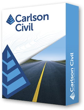
Carlson Civil
Carlson Civil delivers fast, intuitive civil engineering design in 2D and 3D, including roads, sites, and lots. With powerful automation, surface modeling, grading, and earthwork calculations, it accelerates project completion. Compatible with AutoCAD® and IntelliCAD®, it offers accurate design, dynamic road networks, and flexible workflow integration for professionals.
Carlson Civil provides civil engineers with fast, intuitive design tools for roads, sites, and subdivisions. Its dynamic environment supports 2D, 3D, and flyover views to visualize projects clearly.
With Road NETwork, Site NETwork, and Lot NETwork, Carlson Civil automates complex processes that typically take days, allowing engineers to create roads, intersections, lots, and grading surfaces with a single click. Its intuitive layer-based design improves estimating accuracy and streamlines earthwork calculations.
Carlson Civil integrates smoothly with AutoCAD® or IntelliCAD®, offering flexible platform options and affordable upgrades. From profiles, sections, and 3D surfaces to annotations and labeling, it combines powerful automation, precision, and productivity to deliver high-quality civil engineering designs efficiently.
Powerful Road, Site, and Lot Tools
• Road NETwork: Build roads, intersections, and cul-de-sacs in 2D and 3D.
• Site NETwork: Layer-based surface generation and earthwork calculations.
• Lot NETwork: Automatically define subdivisions using user rules.
3D Visualization & Editing
• Dual CAD/3D Viewer for real-time design adjustments.
• Elevate 2D entities to 3D: contours, polylines, and pads.
• 3D flyover and slope analysis with real-time updates.
Profiles & Sections
• Create, edit, and draw profiles from surfaces or points.
• Quick sections and vertical stacks for complete plan documentation.
• Convert profiles and sections to 3D polylines.
Automation & Productivity
• Template design with transitions, superelevation, and road rehabilitation.
• Vehicle path tracking for wheel paths and design checks.
• Cleanup utilities for lot linework and surface updates.
Points, Areas & Annotation
• Draw and manage points, point groups, and coordinate history.
• Label curves, areas, and plat data with flexible annotation tools.
• Lot sizing, intersections, parking, and cul-de-sac layouts.
Flexible Platform & Integration
• Compatible with AutoCAD® (2007+) and IntelliCAD®.
• Supports LandXML, Civil3D, and other standard data formats.
• Multi-language support and document management with Data Depot.
Carlson Civil 2026 – New Features & Improvements
Profiles
- Added recognition of Horizontal Label Box "Draw Vertical Lines" option in Profile Capture
- Added storage of "Draw Label Box Headers" option
- Support for extracting grid settings from Civil3D Profile View objects
- Profile Capture now supports Grid Style "None"
- Support for drawings with active "Twist Screen" view
- Added labeling for minor stations in Draw Profile
- Improved intelligence for various Profile Capture capabilities
- Added several new options to Drawing Profiles
- New command to save profile data from drawings
Sections
- Updated Draw Sections dialog layout to match Draw Profile
- Improved labeling options
- Enhanced performance for large section files
- New command to save section data from drawings
Road Network
- Improved file management for Road Networks
- Added Draw ROW Polylines toggle in Road Network Settings
- Added intersection indicator
- Option to round elevations to building pads
- Updated Template Series Editor to allow editing templates within the editor
- Improved transition template handling for islands
- Improved output file processes
- New command BANKPRO to create stream bank profiles
- Option for a "Smooth" transition between templates
3D Data
- Added offset to surface options in Offset 3D Polyline
- Profile to 3D polyline now allows configuration of vertical curve density
Surface
- Option to display and label Station Offsets in Surface Inspector
- Grid File Utilities now supports combining adjacent grids
- Ability to adjust contours using points from a coordinate file
- TINUTIL command added for TIN transformations
Carlson Software is more than just a purchase—it’s a partnership.
With dedicated Regional Managers across the country, free lifetime technical support, and flexible training options to fit any budget, we’re here to support you every step of the way.
Direct Technical Support
• Hours: Monday – Friday, 9 AM – 5 PM
• Email: tim@carlsongs.com
• Telephone: +1 (716) 799-4187
Similar Products You May Like
Carlson iCAD
Carlson iCAD delivers powerful CAD tools for drafting, design, engineering, and precision workflows.
See Product

Similar Products You May Like

Carlson Hydrology
Carlson Hydrology provides automated 3D stormwater, drainage, and runoff analysis within CAD environments.
See Product

