Carlson Geotech
Carlson Geotech allows engineers and geotechnicians to import borehole data, analyze subsurface conditions, and generate detailed reports for drill logs, cross sections, and plan views. Fully integrated with Carlson Civil and Construction, it ensures accurate site evaluation and precise strata quantity calculations for informed project decisions.

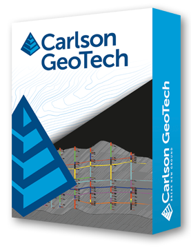
Carlson Geotech is designed for geotechnicians, civil engineers, and construction professionals who need precise subsurface analysis. It enables importing borehole data, modeling core samples, and producing detailed drill logs, cross sections, and plan views.
Integration with Carlson Civil and Construction allows for accurate site stability assessment and strata takeoff estimation. With capabilities to generate geologic columns, fence diagrams, isopach maps, and cut/fill color maps, Carlson Geotech streamlines the process from data collection to actionable engineering insights.
Supported on AutoCAD and IntelliCAD platforms, it offers tools for drawing cleanup, surface modeling, contouring, volume calculations, pad design, and strata visualization, providing a comprehensive solution for subsurface evaluation and construction planning.
Borehole Data Management
• Input and edit drillhole data including strata elevation, depth, and attributes.
• Generate drillhole logs and annotate plan view locations.
• Create geologic columns, fence diagrams, and isopach maps.
Strata Modeling & Analysis
• Draw and model strata surfaces, depth contours, and cut/fill color maps.
• Integrate with Carlson Civil and Construction for strata quantity estimation.
• Calculate volumes by interval for accurate earthwork planning.
Surface & Contour Tools
• Build surfaces via triangulation or grid methods.
• Contour surfaces from 3D entities or surface files.
• Adjust surface properties, add/remove points or breaklines, and swap edges.
Project Integration
• Compatible with Carlson Takeoff Suite for flexible, modular workflows.
• Supports AutoCAD and IntelliCAD, plus LandXML and common data conversions.
• Enhanced drafting tools: Join Nearest, Shrinkwrap, Polyline Utilities, and Layer Inspector.
Carlson Software is more than just a purchase—it’s a partnership.
With dedicated Regional Managers across the country, free lifetime technical support, and flexible training options to fit any budget, we’re here to support you every step of the way.
Direct Technical Support
• Hours: Monday – Friday, 9 AM – 5 PM
• Email: tim@carlsongs.com
• Telephone: +1 (716) 799-4187
Similar Products You May Like

Carlson iCAD
Carlson iCAD delivers powerful CAD tools for drafting, design, engineering, and precision workflows.
See Product

Similar Products You May Like

Carlson Civil
Carlson Civil delivers fast, intuitive 2D and 3D design with automation for roads, sites, and lot networks.
See Product
