Carlson SurveyGNSS
Carlson SurveyGNSS provides post-processing for GNSS data, supporting RINEX and proprietary formats. It ensures centimeter-level accuracy, integrates with Carlson field and office software, and allows quality control of GNSS observations in static, kinematic, and stop-and-go surveys. It also supports automated retrieval of reference data and advanced baseline processing.
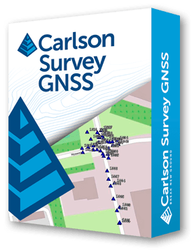
Carlson SurveyGNSS is designed for surveyors and positioning professionals who require centimeter or sub-centimeter accuracy, even in areas without real-time corrections.
The software supports RINEX and multiple proprietary GNSS formats from major manufacturers, including Trimble, Leica, Topcon, NovAtel, Hemisphere, and more. It offers static, kinematic, and stop-and-go positioning modes, with automated baseline processing, cycle-slip detection, and ambiguity resolution for baselines up to 200 km.
SurveyGNSS features an intuitive, workflow-oriented interface with tables, maps, and graphs, enabling efficient quality control of GNSS data before exporting to Carlson Survey, GIS, or other office software. Optional modules include Precise Point Positioning (PPP) and Virtual Reference Station creation for enhanced field flexibility.
Additional capabilities include automated retrieval of reference station data and ephemeris files, least-squares adjustment of vectors, seamless downstream integration, and future-ready support for Galileo, Bediou, and Juntancho GNSS signals.
Comprehensive GNSS Post-Processing
• Supports RINEX and proprietary GNSS formats from major manufacturers.
• Handles static, kinematic, and stop-and-go positioning modes.
• Baseline processing up to 200 km with automated cycle-slip detection and ambiguity resolution.
Intuitive Workflow Interface
• Interactive tables, maps, and graphs for efficient data management.
• Quality control of GNSS data before exporting to Survey or GIS software.
Automated Reference Data
• Automatic search and retrieval of reference geodetic control and CORS station data.
• SP3 precise ephemeris and ionosphere model support.
Advanced Adjustments & Integration
• Rigorous least-squares adjustment of all computed vectors.
• Seamless integration with Carlson Survey, GIS, and other downstream applications.
Optional Modules
• Precise Point Positioning (PPP) for single or dual-frequency receivers.
• Virtual Reference Stations for static and stop-and-go surveys.
Future-Ready
• Support for upcoming Galileo, Bediou, and Juntancho GNSS signals.
• Offline operation available for vector processing and resections.
Carlson Software is more than just a purchase—it’s a partnership.
With dedicated Regional Managers across the country, free lifetime technical support, and flexible training options to fit any budget, we’re here to support you every step of the way.
Direct Technical Support
• Hours: Monday – Friday, 9 AM – 5 PM
• Email: tim@carlsongs.com
• Telephone: +1 (716) 799-4187
Similar Products You May Like
Carlson iCAD
Carlson iCAD delivers powerful CAD tools for drafting, design, engineering, and precision workflows.
See Product

Similar Products You May Like
Carlson Civil
Carlson Civil delivers fast, intuitive 2D and 3D design with automation for roads, sites, and lot networks.
See Product

