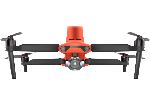
The Autel EVO II Pro RTK is a professional-grade UAS designed for accurate aerial mapping and surveying applications.
Equipped with a 20MP 1-inch sensor camera, detachable RTK module, and FAA Remote ID compliance, it ensures precision
data capture for construction, surveying, and engineering projects.
With up to 36 minutes of flight time, integrated mission planning software, and advanced hovering accuracy, the EVO II
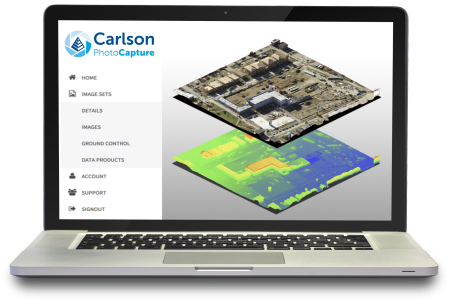
Pro RTK delivers efficient, reliable performance in the field. Data can be processed with Carlson PhotoCapture for
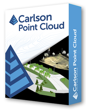
orthoimages, 3D models, and point clouds, or with Carlson Point Cloud for CAD-ready outputs.
Lightweight, durable, and easy to deploy, the EVO II Pro RTK offers portability without sacrificing accuracy, making it
ideal for professionals who require high-resolution deliverables with streamlined workflows.
High-Accuracy Mapping
• Detachable RTK module for centimeter-level accuracy.
• FAA Remote ID compliant system.
• 20MP 1-inch sensor camera with 4K video.
Flight Performance
• Up to 36 minutes of flight time.
• Max horizontal speed of 72 km/h (45 mph).
• Strong wind resistance up to 43 km/h (27 mph).
Control & Mission Planning
• Built-in mission planning software on smart controller.
• Control range up to 9 miles (15 km).
• Visual positioning with advanced hovering accuracy.
Included Accessories
• Smart controller with software, 3 batteries, chargers, SD card.
• 10 ground targets for precision workflows.
• Rugged hard case, spare propellers, neck strap.
Software Integration
• Seamless with Carlson PhotoCapture (orthoimages, TINs, point clouds).
• Works with Carlson Point Cloud Advanced for CAD deliverables.
Weight: 1237 g ±0.5 g (with propeller and battery)
Wheelbase: 397 mm
Max Service Ceiling: 6000 m
Ascent Speed: 5 m/s (auto), 8 m/s (manual)
Descent Speed: 4 m/s
Max Flight Speed: 72 km/h (45 mph)
Max Tilt Angle: 33°
Max Angular Velocity: 120°/s
Max Flight Time: 36 minutes
Operating Temp: -10°C to 40°C
Wind Resistance: 43 km/h (27 mph)
Operating Frequencies: 2.4GHz (2.400–2.4835 GHz), 5.7–5.850 GHz (non-Japan), Japan 2.400–2.4835 GHz / 5.650–5.755 GHz
Hovering Accuracy: ±0.1 m vertical & horizontal (RTK enabled), ±0.3–1.5 m (GNSS/visual only)
Image Position Compensation: Offset (-2.63, 0.31, 83.5) mm relative to RTK antenna
Camera: 20MP, 1-inch sensor, 4K video
Controller: Smart controller with mission planning, 5.5-inch display
Carlson Software is more than just a purchase—it’s a partnership.
With dedicated Regional Managers across the country, free lifetime technical support, and flexible training options to fit any budget, we’re here to support you every step of the way.
Direct Technical Support
• Hours: Monday – Friday, 9 AM – 5 PM
• Email: tim@carlsongs.com
• Telephone: +1 (716) 799-4187