Carlson Point Cloud
Carlson Point Cloud processes point cloud data from aerial, ground, and photogrammetry sources. It extracts curbs, parking lines, sidewalks, and building outlines, removes vegetation and objects, generates contours, profiles, and volumes, and automates CAD drafting with field-to-finish functionality for survey-grade outputs.
Carlson Point Cloud is a modular software for handling point cloud data from LiDAR, photogrammetry, and ground scans, enabling surveyors and engineers to create maps and CAD deliverables from any dataset.
Key capabilities include machine learning-based feature extraction for curbs, parking lines, paint stripes, sidewalks, building outlines, and powerlines. The software supports bare-earth filtering, contour and profile generation, volume calculations, and advanced field-to-finish drafting.
Carlson Point Cloud allows importing/exporting multiple formats (LAS, Leica, Faro, E57, DEM, GeoTIFF, RCP), consolidating multiple scans, decimating clouds, colorizing points, and automated breakline creation. Both Basic and Advanced versions offer linework creation, CAD integration, and smart feature extraction tools for high-efficiency workflow.
Advanced tools include additional filters, transformations, feature-type point and solid creation, and seamless CAD entity generation, allowing professionals to rapidly convert raw point clouds into actionable, accurate survey and engineering data.
Point Cloud Data Management
• Import/export LAS, Leica, Faro, E57, DEM, GeoTIFF, RCP formats.
• Consolidate multiple scans into single clouds.
• Reduce size and noise with decimation, cleaning, and resampling tools.
Feature Extraction
• Machine learning extraction of curbs, parking lines, sidewalks, paint stripes, and building outlines.
• Automated CAD linework and field-to-finish support for symbols, linework, and labels.
Bare Earth & Surface Processing
• Remove vegetation, cars, and buildings.
• Generate contours, profiles, cross-sections, and volume calculations.
• Automatic 3D breakline creation based on surface zones.
Advanced CAD Integration
• Multiple snap modes for edge and slope extraction.
• Load surfaces from scans and view in 3D.
• Export processed data to ASCII, LAS, RCP, or PDF.
Visualization & Analysis
• Color adjustment, multiple cloud viewing, and color by elevation or intensity.
• Generate precise site models for mapping, design, and engineering deliverables.
Carlson Point Cloud 2026 – New Features & Improvements
General
- Improved reporting and options for Cloud Compare routine
- Added Feature Completion routines to Point Cloud drop-down menu
- Added ability to compare points to TINs or fixed elevations in Point Cloud Compare routine
- Added Clear option for Point Cloud ortho image
- Improved file management for Point Cloud projects
- Improved project settings retention for new project creation
- Added Snap Mode controls to Select by Sphere routine
- Last opened project is now recalled between runs
Feature Extraction & Profiles
- Best Fit Roundabout Routine now reports standard deviation and average residuals
- Added summary of fitted/simplified profile data in Extract Profile routine
- Improved tooltip when selecting "Extract Along" polyline
- Improved prompts for modifying existing clouds
- Improved profile extraction control and documentation
Scene & Surface Tools
- Improved Scene viewing contrast
- Added units display to Bare Earth by Grid method
- Added Delete Polyline to Screen Pick Action drop-down menu for one-click deletion
- Merge Cloud Dialog now saves Color and Intensity toggle settings and updates according to attributes
Feature Extraction Enhancements
- Feature Extraction drop-down now includes combined parking lines and paint stripes extraction tool
- Best Fit Roundabout feature completion added to clean up extracted roundabouts
Carlson Software is more than just a purchase—it’s a partnership.
With dedicated Regional Managers across the country, free lifetime technical support, and flexible training options to fit any budget, we’re here to support you every step of the way.
Direct Technical Support
• Hours: Monday – Friday, 9 AM – 5 PM
• Email: tim@carlsongs.com
• Telephone: +1 (716) 799-4187
Similar Products You May Like
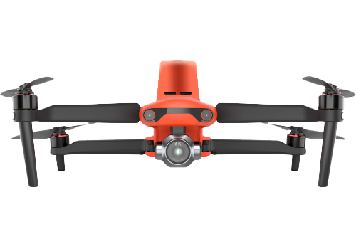
Autel EVO II Pro RTK
Compact RTK drone with 20MP 1-inch sensor, detachable RTK module, and 36 minutes of flight time.
See Product

